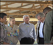
 One man who knows those realities all too well is Raphael Manzanero. He's the Executive Director of Friends for Conservation and Development. He accompanied Almagro, acting as his aerial guide, pointing out areas in the Chiquibul Forest and the Caracol Archaeological park that had been or are being illegally cleared by Guatemalans. The FCD co-manages the Chiquibul, and as part their monitoring of the illegal incursions into the national park, they do regular fly-overs to map the constant de-forestation.
When it was over, Manzanero described what Almagro saw:
Voice of: Rafael Manzanerero, Executive Director - FCD
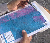
"We flew from Central Farm. This is way up here, so it really wouldn't show it on the map, but we are around here, went down to by Benque Viejo, we passed going along the border, then we flew south. So we travelled all along this route from north to south. We saw some of the illegal activities in the Vaca Forest Reserve. In fact there was a large area, about 2/3 of a big field is in the Guatemalan side and about 1/3 was inside of Belize."
"In fact along that area there on the edge of that big clearing, there is also a marijuana field. So we continued along the Vaca. The Vaca has several areas that is now being cleared. In fact it is not even known at this stage who is actually are living in that area, but these are Guatemalans and what is happening there is now a development of cattle farming along this area here."
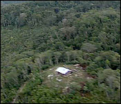
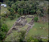
"We continued on, right then we went up to this point where there is the Valetin Conservation Post, that is the small little house which is overlooking in directly into the village of La Rejoya in Guatemala. There is a large clearance. In fact the Guatemalans reach up to about 2.5 kilometers in terms of building farms. So the conservation post was placed there strategically to control the human footprint. Then we turned around, we went to Caracol along the temples that you saw. So we practically reached only up to around this point. We did not go into more the southern part of Chiquibul where more further south that's where you would see a lot of the other clearings, for this is the most hottest spots right now which is the Cebada where it is now proposed to build the other conservation post."
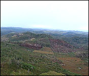
A March 1st report from the FCD says that a fly-over on February 23, 2017 showed that 156 patches have been cleared, totalling almost 1,320 acres of forest cover lost.
The cleared patches of mature forest were connected to previously used fields for milpa farming, and that made it difficult to measure how much of the clearings were new. The over-flight team detected 5 illegal huts, and 3 suspected marijuana fields. All the huts were located within large clearings, and are concentrated around the Cebada and South Cebada area.
|