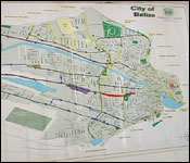
The Hurricane Season is approaching and as a part of CEMO'S annual strategic plan the Belize City Council held its official evacuation meeting today at City Hall. The initial layout of the city's emergency evacuation route for Belize City was named. There will be 70 evacuation route signs installed along the emergency route for both north and south side of Belize City. We found out more:
Phillip Willoughby - Councilor in charge of CEMO "As you can see there will be seventy evacuations route signs depicted along the emergency evacuation route for both north die and south side Belize City. As well as these emergency assembly point signs that will be strategically positioned for assembly areas to evacuate residence during a national disaster emergency. These locations will be north side, the Brodies parking lot, Lopez Mateos Park, Cinderella Plaza north side. Southside will be the Wilton Cumberbatch field, the football field on Fabers Road extension and the basket ball court behind Jane Usher Boulevard as well as the bus terminal on West Collet Canal. These signs will be directed and they will be there full time. This is the first time for the evacuation outlook when it comes to the transport portfolio and there are other committees, nine others of which we meet on every three weeks here at the Council as the City Emergency Management committees and all these aspects are looked at during our national City's' discussion as well as the meetings that occur at the national level with NEMO."
The council will be hosting a Disaster Preparedness Training on Thursday that for the City's Operation Management and Shelter Management Team.


 The Hurricane Season is approaching and as a part of CEMO'S annual strategic plan the Belize City Council held its official evacuation meeting today at City Hall. The initial layout of the city's emergency evacuation route for Belize City was named. There will be 70 evacuation route signs installed along the emergency route for both north and south side of Belize City. We found out more:
 "As you can see there will be seventy evacuations route signs depicted along the emergency evacuation route for both north die and south side Belize City. As well as these emergency assembly point signs that will be strategically positioned for assembly areas to evacuate residence during a national disaster emergency. These locations will be north side, the Brodies parking lot, Lopez Mateos Park, Cinderella Plaza north side. Southside will be the Wilton Cumberbatch field, the football field on Fabers Road extension and the basket ball court behind Jane Usher Boulevard as well as the bus terminal on West Collet Canal. These signs will be directed and they will be there full time. This is the first time for the evacuation outlook when it comes to the transport portfolio and there are other committees, nine others of which we meet on every three weeks here at the Council as the City Emergency Management committees and all these aspects are looked at during our national City's' discussion as well as the meetings that occur at the national level with NEMO."